Bangkok · Chiang Mai · Pai · Ko Lanta · Ao Nang
Thailand itinerary in 3 weeks: Bangkok, Chiang Mai, Pai, Ko Lanta and Ao Nang
A twenty-night Thailand trip from the temples and hills of the north to the beaches of the Andaman Sea.
20 nights, 5 stops Best time to travel: November to February
Best time to go, weather and road tips
-
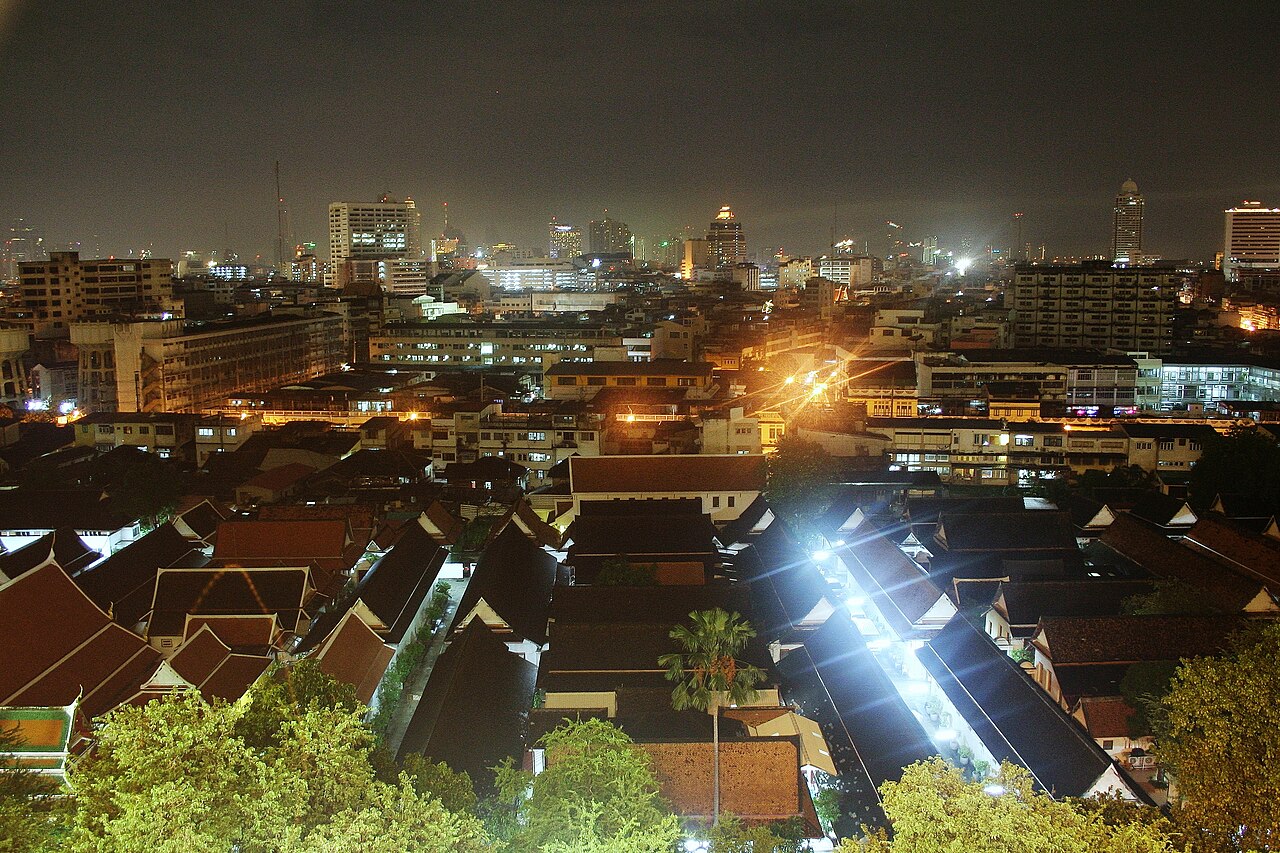
Photo: Random username 083794703875938, CC0 1.0, cropped Bangkok
3 nights
Three nights are enough for exploring the old town near the river and having an evening out in Chinatown. The most famous places to see are located on Rattanakosin Island. This is the old town on the east side of the Chao Phraya river. You will find the Grand Palace here. Close to it is Wat Pho, which has a large Buddha statue lying down. You should plan to spend half a day at the palace. Wat Arun is on the other side of the river. A ferry will take you across to it.
The Chao Phraya Express Boat is a useful way to travel around. It stops at Tha Chang pier near the palace and at Tha Tien pier near Wat Pho. At night, you should go to Yaowarat Road in Chinatown. This street has seafood restaurants and street markets that are worth seeing. If you want to visit the newer parts of the city, use the Skytrain. The Sukhumvit line and the Silom line of the Skytrain meet at Siam Square.
Good areas to stay
- Banglamphu (Khao San Road)
- You can find many cheap places to sleep in the northern part of the old town. The express boat leaves from the nearby Phra Arthit pier and takes you to temples by the river.
- Silom
- During the day this is where businesses operate. When night comes, it becomes a place for entertainment and going out. You can take the Skytrain's Silom Line to reach the river. The boats stop there.
- Sukhumvit
- You will find a lengthy street that has many hotels, eating places, and drinking establishments. The Skytrain travels along the road.
On to Chiang Mai: about 1 h 15 by plane
-
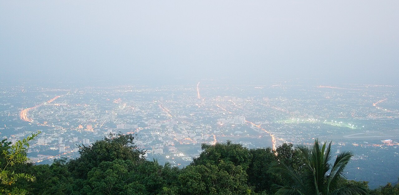
Photo: Random username 083794703875938, CC0 1.0, cropped Chiang Mai
4 nights
You can spend four nights seeing the old town, visiting Doi Suthep mountain, and spending an evening at the market. The old town forms a square that measures about 1.6 km on each side and has a moat around it. Only the gates and corners of the old wall remain standing. You will find more than 30 temples inside the old town, and because everything is close together, you can easily walk around.
The mountain Doi Suthep is to the west of the city. The temple Wat Phra That Doi Suthep sits on the mountain's slope about 13 km from the old town. You can take shared trucks called songthaews that leave from Chang Phuak Gate on the north side of the old town. Every Sunday evening, Ratchadamnoen Road becomes a large market where you can buy crafts and food. The market starts at Tha Phae Gate.
Good areas to stay
- Old town
- You can stroll to the temples if you stay inside the moat. Most of the things you need as a traveller are near Tha Phae Gate.
- Nimmanhaemin
- To the northwest of the historic city center close to where the university is located, you will find many cafés and bars. From this area, the road that goes up to Doi Suthep begins not far away.
- Night Bazaar by the Ping River
- You will find most of the city's hotels to the east of the old town. They line Chang Khlan Road. When evening comes, the Night Bazaar is right outside your door.
On to Pai: about 4 h by minibus
-
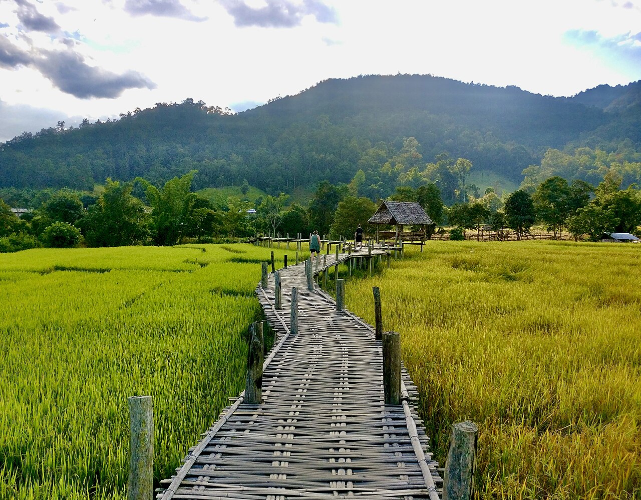
Photo: Eerin25, CC0 1.0, cropped Pai
3 nights
Pai is a small town in a wide valley. It is north of Chiang Mai. The distance by road is about 130 km. Route 1095 going there has steep sections and many bends. If you get carsick easily, you should take something for it before you go. The town is small. You can walk around it easily. During high season, food stalls appear on the Walking Street in the evening.
Three nights give you time to see the area around the town. You can rent bicycles and scooters on the main street. Pai Canyon is about 8 km from town on the road to Chiang Mai. It has narrow red ridges with steep sides. Sunset is the best time to visit. Some of the paths there are very narrow. There are no scheduled flights from Pai. To go south, you must go back through Chiang Mai. You take a minibus to the city. Then you take a plane to Krabi. After that you take a minibus to Ko Lanta.
Good areas to stay
- Town centre on the Walking Street
- You will find yourself surrounded by places to eat and evening stalls. The bus station sits within the town itself.
- East bank across the bamboo bridge
- On the other side of the bamboo bridge that crosses the Pai River, you will find basic huts right next to the water. These huts are more peaceful than the main town area. They are just a few hundred metres away from the centre.
On to Ko Lanta: about 8 h 30 by bus and plane
-
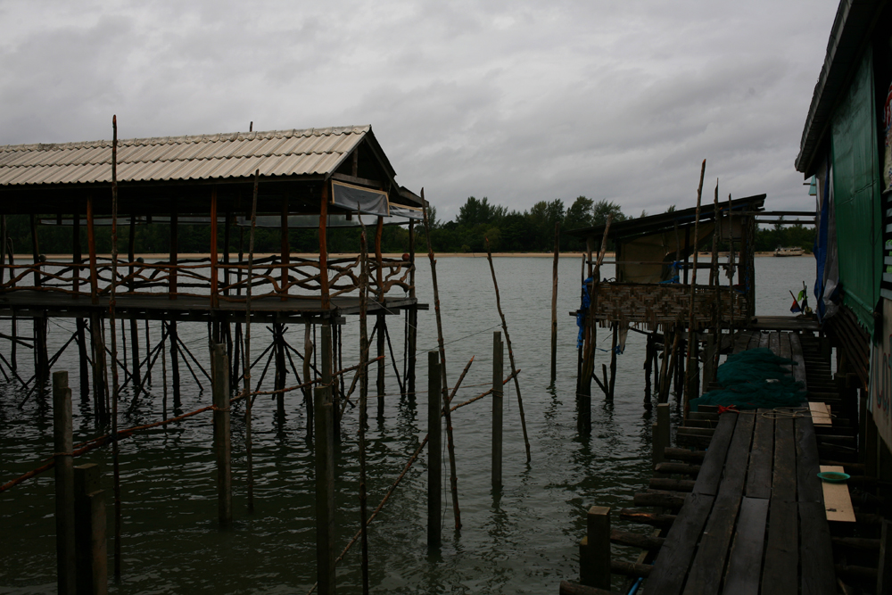
Photo: Paolobon140, CC0 1.0, cropped Ko Lanta
6 nights
Ko Lanta Yai is the main island in the Lanta group. It stretches more than 30 km long and measures about 6 km wide. The west coast has several sandy beaches. The further south you travel, the more peaceful the area becomes. You can take a minibus from Krabi airport that gets you to the island in 2 to 2.5 hours. During this journey, you cross by car ferry from the mainland to Ko Lanta Noi. Then a bridge takes you on to Ko Lanta Yai. The ferry wait can be long in December and January. Saladan sits in the north as the small main town. You will find shops, banks and dive operators here. Boats dock at Saladan too. On the east coast you can visit Lanta Old Town. This was once the island's port and trading post. It still has old Chinese-style houses.
Mangroves cover the east side of the island. You can go kayaking in these mangrove areas. At the far south sits Mu Ko Lanta National Park. A trail of about 2 km leads you to a small beach and an old lighthouse. Six nights on the island give you enough time for several beach days. You can also take a snorkelling or diving trip. A scooter ride around the island is another good way to spend your time.
Good areas to stay
- Klong Dao
- You will find a beach that stretches for 3 km near Saladan. The water here is not deep and you can see through it easily. You can find restaurants and bars close by.
- Long Beach (Phra Ae)
- You will find a sandy curve that stretches for about 4 km along the northern part of the island. There are many options for places where you can stay. They are spread out in a way that helps keep the area peaceful.
- Kantiang Bay
- You will find this spot roughly 18 km to the south of Saladan. There are just a small number of hotels here. The coral in the area is good for snorkelling.
On to Ao Nang: about 2 h by speedboat
-
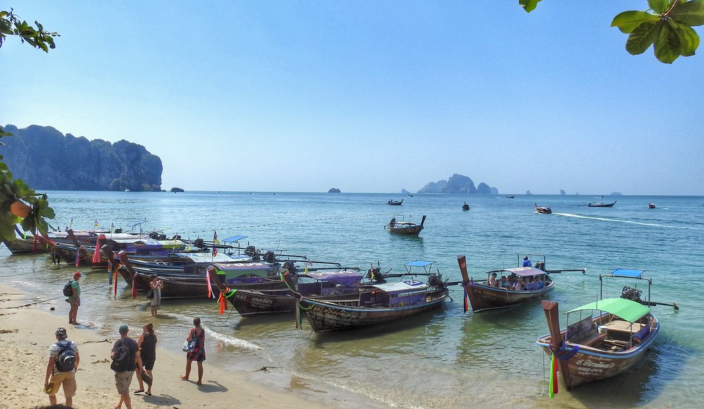
Photo: Dennis S. Hurd, CC0 1.0, cropped Ao Nang
4 nights
Ao Nang is a beach town located in Krabi Province. It sits about 15 km away from Krabi Town. Most importantly, it works well as a place to stay and explore from. When you want to leave, Krabi airport is roughly 40 minutes away if you drive there by car. You can catch longtail boats right from the beach itself. The trip to Railay West by boat takes around 10 minutes. Railay is a peninsula. Tall limestone cliffs surround it. You cannot drive there by road. The only way to reach it is by boat. People go there to climb the cliffs. You will find Phra Nang beach at the southern end of the peninsula. From the main beach in Ao Nang, boats also go out to small islands near the shore. Ko Poda and Chicken Island are two examples of these islands.
You could spend two days out on the water. Then you could spend the days between those water trips on the beach. Keep in mind that boats only leave when weather conditions are suitable. The busy season lasts from roughly November through April.
Good areas to stay
- Ao Nang Beach
- You will find restaurants, shops and travel agents along the street that runs behind the beach. The boats that go to Railay depart from this same area.
- Nopparat Thara
- There is a long beach located in the national park. You will find it just west of Ao Nang. The western half of this beach is very peaceful and quiet. A pier sits on the beach where you can catch boats that go out to the islands.
- Railay
- You can only get there by water, so you will be positioned directly among the cliffs and beaches. However, every trip you take will begin with traveling by boat.
Good to know
Your journey begins in Bangkok. You fly to Chiang Mai next. Then you take a minibus into the hills to reach Pai. After that, you go back through Chiang Mai and fly to Krabi. From there you travel to the island of Ko Lanta. A boat or minibus will bring you back to the coast at Ao Nang. You fly out from Krabi airport which is close by. Between November and February, the north becomes cooler.
Best time to visit Thailand
The average daily high for each month and how often it rains. The sun marks a dry month, not hours of sunshine.
- dry, fewer than 4 rainy days
- 4 to under 8 rainy days
- 8 to under 12 rainy days
- 12 or more rainy days
- Jan: 30 degrees, 1.0 rainy days
- Feb: 33 degrees, 0.7 rainy days
- Mar: 35 degrees, 2.1 rainy days
- Apr: 37 degrees, 4.7 rainy days
- May: 35 degrees, 12.0 rainy days
- Jun: 33 degrees, 11.6 rainy days
- Jul: 32 degrees, 14.4 rainy days
- Aug: 32 degrees, 17.1 rainy days
- Sep: 32 degrees, 14.7 rainy days
- Oct: 32 degrees, 9.1 rainy days
- Nov: 31 degrees, 3.0 rainy days
- Dec: 29 degrees, 1.2 rainy days
Exact figures
Average daily highs and lows 1991–2020, precipitation as monthly total.
| Jan | Feb | Mar | Apr | May | Jun | Jul | Aug | Sep | Oct | Nov | Dec | |
|---|---|---|---|---|---|---|---|---|---|---|---|---|
| Daily high (°C) | 30.0 | 32.9 | 35.4 | 36.7 | 34.7 | 33.2 | 32.1 | 31.6 | 32.0 | 31.7 | 30.8 | 29.2 |
| Daily low (°C) | 15.7 | 16.8 | 20.1 | 23.4 | 24.2 | 24.5 | 24.3 | 24.0 | 23.7 | 22.6 | 19.9 | 16.9 |
| Precipitation (mm) | 11.3 | 9.6 | 20.4 | 54.3 | 167.5 | 118.2 | 148.6 | 223.3 | 207.2 | 123.8 | 40.9 | 14.1 |
| Days with at least 1 mm | 1.0 | 0.7 | 2.1 | 4.7 | 12.0 | 11.6 | 14.4 | 17.1 | 14.7 | 9.1 | 3.0 | 1.2 |
| Month | High (°C) | Low (°C) | Precip. (mm) | Days ≥ 1 mm |
|---|---|---|---|---|
| Jan | 30.0 | 15.7 | 11.3 | 1.0 |
| Feb | 32.9 | 16.8 | 9.6 | 0.7 |
| Mar | 35.4 | 20.1 | 20.4 | 2.1 |
| Apr | 36.7 | 23.4 | 54.3 | 4.7 |
| May | 34.7 | 24.2 | 167.5 | 12.0 |
| Jun | 33.2 | 24.5 | 118.2 | 11.6 |
| Jul | 32.1 | 24.3 | 148.6 | 14.4 |
| Aug | 31.6 | 24.0 | 223.3 | 17.1 |
| Sep | 32.0 | 23.7 | 207.2 | 14.7 |
| Oct | 31.7 | 22.6 | 123.8 | 9.1 |
| Nov | 30.8 | 19.9 | 40.9 | 3.0 |
| Dec | 29.2 | 16.9 | 14.1 | 1.2 |
- Jan: 33 degrees, 2.6 rainy days
- Feb: 34 degrees, 1.8 rainy days
- Mar: 34 degrees, 4.8 rainy days
- Apr: 34 degrees, 9.0 rainy days
- May: 33 degrees, 14.2 rainy days
- Jun: 32 degrees, 15.1 rainy days
- Jul: 32 degrees, 14.9 rainy days
- Aug: 31 degrees, 14.8 rainy days
- Sep: 31 degrees, 17.0 rainy days
- Oct: 31 degrees, 17.9 rainy days
- Nov: 31 degrees, 12.3 rainy days
- Dec: 31 degrees, 7.8 rainy days
Exact figures
Average daily highs and lows 1991–2020, precipitation as monthly total.
| Jan | Feb | Mar | Apr | May | Jun | Jul | Aug | Sep | Oct | Nov | Dec | |
|---|---|---|---|---|---|---|---|---|---|---|---|---|
| Daily high (°C) | 32.6 | 33.5 | 33.9 | 33.8 | 32.6 | 31.9 | 31.6 | 31.2 | 30.9 | 31.0 | 31.3 | 31.4 |
| Daily low (°C) | 24.1 | 24.4 | 24.7 | 25.1 | 25.4 | 25.3 | 25.1 | 25.2 | 24.8 | 24.5 | 24.3 | 23.9 |
| Precipitation (mm) | 31.0 | 24.1 | 69.0 | 121.6 | 227.5 | 285.9 | 288.5 | 342.0 | 319.4 | 297.5 | 148.4 | 64.6 |
| Days with at least 1 mm | 2.6 | 1.8 | 4.8 | 9.0 | 14.2 | 15.1 | 14.9 | 14.8 | 17.0 | 17.9 | 12.3 | 7.8 |
| Month | High (°C) | Low (°C) | Precip. (mm) | Days ≥ 1 mm |
|---|---|---|---|---|
| Jan | 32.6 | 24.1 | 31.0 | 2.6 |
| Feb | 33.5 | 24.4 | 24.1 | 1.8 |
| Mar | 33.9 | 24.7 | 69.0 | 4.8 |
| Apr | 33.8 | 25.1 | 121.6 | 9.0 |
| May | 32.6 | 25.4 | 227.5 | 14.2 |
| Jun | 31.9 | 25.3 | 285.9 | 15.1 |
| Jul | 31.6 | 25.1 | 288.5 | 14.9 |
| Aug | 31.2 | 25.2 | 342.0 | 14.8 |
| Sep | 30.9 | 24.8 | 319.4 | 17.0 |
| Oct | 31.0 | 24.5 | 297.5 | 17.9 |
| Nov | 31.3 | 24.3 | 148.4 | 12.3 |
| Dec | 31.4 | 23.9 | 64.6 | 7.8 |
Through the year
- May, Jun, Jul, Aug, Sep, Oct: Rain falls regularly from around the middle of May until around the middle of October. The months of August and September get the most rainfall. Source: Thai Meteorological Department, accessed 12 Oct 2026
Summarised and translated for this page from the linked sources.
Monthly values Chiang Mai: WMO Member Nations (2023). WMO Climatological Standard Normals for 1991-2020 (NCEI Accession 0253808). Version 6.6, min24, WMO station 48327, TMAX TMIN PRCP DP01. NOAA National Centers for Environmental Information. Dataset. https://doi.org/10.25921/800j-vn07. Accessed 12 Oct 2026.
Monthly values Ko Lanta: WMO Member Nations (2023). WMO Climatological Standard Normals for 1991-2020 (NCEI Accession 0253808). Version 6.6, min24, WMO station 48566, TMAX TMIN PRCP DP01. NOAA National Centers for Environmental Information. Dataset. https://doi.org/10.25921/800j-vn07. Accessed 12 Oct 2026.
The stops and nights are already filled in. You add your travel dates, the briefing finds the places to stay.
Turn this route into your own briefingDestination texts created with AI.
As of 12 Oct 2026