Colombo · Sigiriya · Kandy · Ella · Galle
Sri Lanka itinerary in 3 weeks: Colombo, Sigiriya, Kandy, Ella and Galle
A 20-night Sri Lanka trip from Colombo via Sigiriya's Lion Rock, Kandy and Ella to Galle on the south coast.
20 nights, 5 stops Best time to travel: December to April
Best time to go, weather and road tips
-
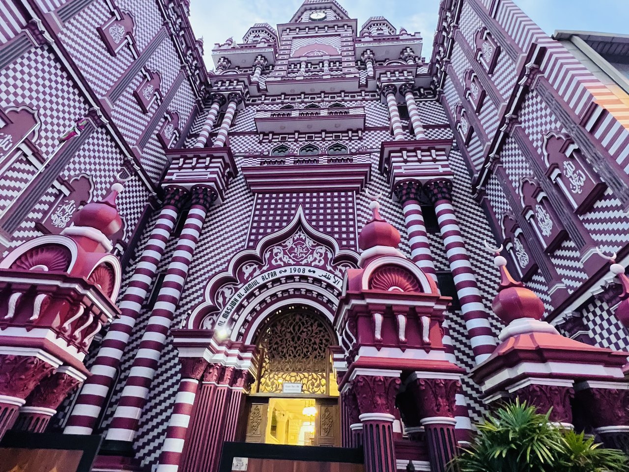
Photo: Kyassin75, CC0 1.0, cropped Colombo
3 nights
Colombo is Sri Lanka's biggest city and serves as the country's business hub. If you take a taxi from the airport, you will reach the city in about 45 minutes by using the expressway. In the old Fort area, you can find Galle Face Green stretching along the ocean. This green space runs for about 500 metres along the coast. On weekends, many people visit it in the evening.
To the east of Fort, you will discover Pettah, which has many markets. A red and white striped mosque called Jami Ul-Alfar Mosque stands there. It was completed in 1909. On Beira Lake sits the Buddhist temple of Gangaramaya. This temple combines building styles from Sri Lanka, Thailand, India and China. Three nights are enough. This gives you time to arrive after your flight and explore the city without rushing.
Good areas to stay
- Fort
- The ancient part of town sits by the ocean. You can visit Galle Face Green there. The Dutch Hospital is the oldest structure in this part of the city. To the east of these places, you will find Pettah.
- Beira Lake (Slave Island)
- You will find homes and shops in this part of town. It sits on Beira Lake. The Gangaramaya temple is near. Seema Malaka is also close by.
- Mount Lavinia
- You can find this place on the beach south of where the city ends. It is roughly 20 minutes away from the city. You will see restaurants sitting directly on the sand.
On to Sigiriya: about 3 to 4 h by car
-
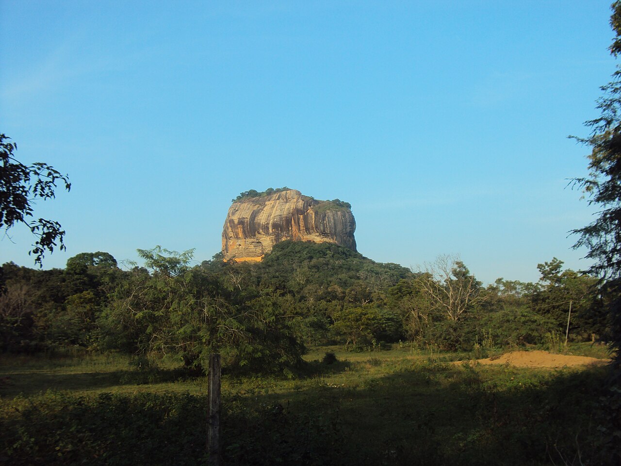
Photo: Yourusernamewillbepublic2, CC0 1.0, cropped Sigiriya
4 nights
Sigiriya's Lion Rock stands about 180 metres high above the land that surrounds it. In the 5th century, King Kassapa I made his capital on top of this rock and on its sides. Now it is a UNESCO World Heritage Site. You climb up past old water gardens and walk through galleries with many stairs.
If you stay for four nights, you have time to see more things. Pidurangala Rock sits about one kilometre to the north. From there you can look across and see Lion Rock. The Dambulla cave temple has five cave shrines inside it and is about 20 km away. Polonnaruwa was the country's second capital after the year 993. It is about 55 km away if you travel by road.
Good areas to stay
- Sigiriya village
- You are close to where you enter at Lion Rock. You are also near the water gardens that sit on the western side of Lion Rock.
- Towards Pidurangala
- You can find this place north of Lion Rock. Pidurangala Rock is roughly one kilometre from here.
- Habarana
- There is a small town located roughly 11 km north of here. It has a small railway station. You are able to rent jeeps in this town. You can use these jeeps to visit an eco park nearby. In the eco park you can see wild elephants.
On to Kandy: about 2 h 30 by car
-
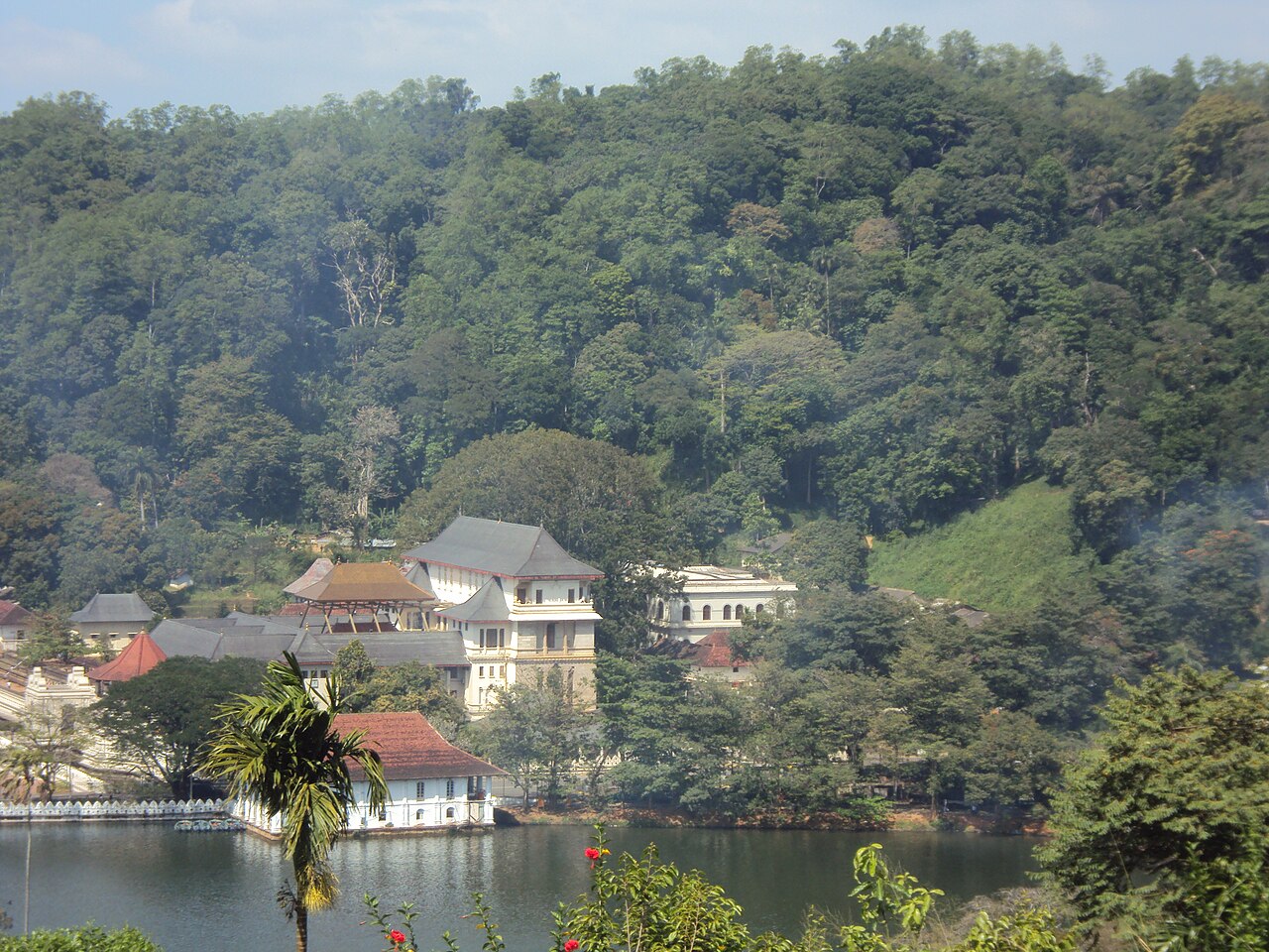
Photo: Yourusernamewillbepublic2, CC0 1.0, cropped Kandy
3 nights
Kandy was where the last Sinhalese kings ruled until the British took over the island in 1815. You can visit it today as a UNESCO World Heritage Site. The Temple of the Tooth (Sri Dalada Maligawa) holds a tooth belonging to the Buddha and many people travel there to pray. In front of this temple you will find Kandy Lake. King Sri Wickrama Rajasinha ordered this lake to be built in 1807. If you go 5.5 km west, you reach the Royal Botanic Gardens of Peradeniya. You can see more than 4000 different plant species there and many orchids grow in the gardens.
Three nights are enough to see the temple, the lake and the gardens without rushing. Storms damaged the railway into the hill country in late 2025 and trains stopped running for several months. Before you go, you should find out if trains are running from Kandy to Ella again.
Good areas to stay
- Around Kandy Lake
- The Temple of the Tooth is located beside the lake. You can walk to the city centre from there.
- Peradeniya
- You will find this place roughly 6 km in the western direction close to the botanic gardens. It is also near Peradeniya Junction railway station.
On to Ella: about 4 h by car
-
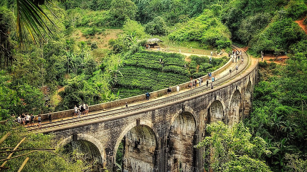
Photo: Dennis S. Hurd, CC0 1.0, cropped Ella
4 nights
Ella is a small town in the hills. It sits at about 1040 metres high. Tea plants and cloud forest surround you there. The air is cooler than down in the low areas. You can look through the Ella Gap and see far out across the plains to the south. A hill called Little Adam's Peak stands to the southeast of the town. It reaches 1141 metres high.
The Nine Arch Bridge is near Demodara, which is east of town. It is a concrete railway bridge with nine arches. You can also visit Ella Rock, which is a good place to look out from. The Ravana Ella waterfall is about 6 km from town. It drops 25 metres down. If you stay for four nights you can hike on several different days. This also gives you an extra day in case rain comes.
Good areas to stay
- In town
- The train station and the main part of town are near each other.
- Towards Little Adam's Peak
- You will find this place to the southeast of town. It sits closer to the path that goes up the hill.
- Towards the Nine Arch Bridge
- You will find this place to the east of the town. It lies towards Demodara and is situated by the bridge.
On to Galle: about 3 h by car
-
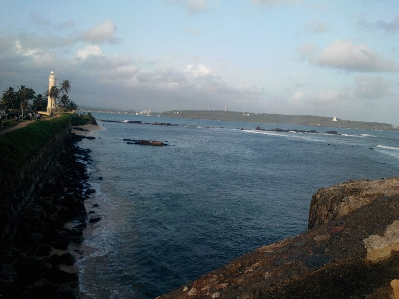
Photo: Aashaa, CC0 1.0, cropped Galle
6 nights
Galle is located on a small rocky point on the southwest coast. The Portuguese built the fortified town during the 16th century. It became most important when the Dutch ruled it in the 18th century. The old town and its walls are now protected as a UNESCO World Heritage Site. Inside the walls you will find streets laid out in a grid pattern. You will see houses that have verandas covered by large roofs. There are churches, a mosque, a clock tower and a lighthouse. You can walk along the ramparts with the sea beside you.
If you stay for six nights, you will have enough time to explore the old town's streets and also spend time at the beach. Unawatuna is about 6 km to the east and has a beach with coral reefs in the water nearby. You could spend a day in Mirissa, which is about 45 minutes away by car. This fishing town is one of the main places in the country to see whales and dolphins. Research done off Mirissa found many blue whales between December and April. When you are ready to fly home, you will need about two hours to drive to the airport near Colombo.
Good areas to stay
- Inside the fort (Galle Fort)
- You can explore the area inside the ancient fortifications on foot. The walls, defensive structures, the lighthouse and the narrow streets are all accessible to you without needing transport.
- Unawatuna
- You will find a beach about 6 km to the east. There are coral reefs in the water offshore.
Good to know
Your trip begins in Colombo. It goes to Sigiriya's Lion Rock, then through Kandy into the tea hills near Ella. It finishes on the south coast in Galle, which is roughly two hours from the airport. You move from one place to the next by car. The longest drive takes about four hours.
Best time to visit Sri Lanka
The average daily high for each month and how often it rains. The sun marks a dry month, not hours of sunshine.
- dry, fewer than 4 rainy days
- 4 to under 8 rainy days
- 8 to under 12 rainy days
- 12 or more rainy days
- Jan: 31 degrees, 4.9 rainy days
- Feb: 32 degrees, 5.1 rainy days
- Mar: 32 degrees, 7.7 rainy days
- Apr: 32 degrees, 12.6 rainy days
- May: 32 degrees, 16.6 rainy days
- Jun: 31 degrees, 15.2 rainy days
- Jul: 30 degrees, 10.0 rainy days
- Aug: 30 degrees, 10.2 rainy days
- Sep: 30 degrees, 15.2 rainy days
- Oct: 30 degrees, 18.6 rainy days
- Nov: 31 degrees, 16.0 rainy days
- Dec: 31 degrees, 9.0 rainy days
Exact figures
Average daily highs and lows 1991–2020, precipitation as monthly total.
| Jan | Feb | Mar | Apr | May | Jun | Jul | Aug | Sep | Oct | Nov | Dec | |
|---|---|---|---|---|---|---|---|---|---|---|---|---|
| Daily high (°C) | 31.4 | 31.6 | 32.0 | 32.0 | 31.5 | 30.7 | 30.3 | 30.3 | 30.4 | 30.4 | 30.6 | 30.9 |
| Daily low (°C) | 23.1 | 23.6 | 24.8 | 25.3 | 26.2 | 26.1 | 25.9 | 25.9 | 25.4 | 24.7 | 23.9 | 23.5 |
| Precipitation (mm) | 79.6 | 77.4 | 102.7 | 248.9 | 313.6 | 196.7 | 122.6 | 115.5 | 264.2 | 359.3 | 345.8 | 170.7 |
| Days with at least 1 mm | 4.9 | 5.1 | 7.7 | 12.6 | 16.6 | 15.2 | 10.0 | 10.2 | 15.2 | 18.6 | 16.0 | 9.0 |
| Month | High (°C) | Low (°C) | Precip. (mm) | Days ≥ 1 mm |
|---|---|---|---|---|
| Jan | 31.4 | 23.1 | 79.6 | 4.9 |
| Feb | 31.6 | 23.6 | 77.4 | 5.1 |
| Mar | 32.0 | 24.8 | 102.7 | 7.7 |
| Apr | 32.0 | 25.3 | 248.9 | 12.6 |
| May | 31.5 | 26.2 | 313.6 | 16.6 |
| Jun | 30.7 | 26.1 | 196.7 | 15.2 |
| Jul | 30.3 | 25.9 | 122.6 | 10.0 |
| Aug | 30.3 | 25.9 | 115.5 | 10.2 |
| Sep | 30.4 | 25.4 | 264.2 | 15.2 |
| Oct | 30.4 | 24.7 | 359.3 | 18.6 |
| Nov | 30.6 | 23.9 | 345.8 | 16.0 |
| Dec | 30.9 | 23.5 | 170.7 | 9.0 |
- Jan: 29 degrees, 7.6 rainy days
- Feb: 30 degrees, 6.1 rainy days
- Mar: 32 degrees, 6.8 rainy days
- Apr: 31 degrees, 13.2 rainy days
- May: 30 degrees, 10.4 rainy days
- Jun: 29 degrees, 13.6 rainy days
- Jul: 28 degrees, 12.5 rainy days
- Aug: 29 degrees, 11.4 rainy days
- Sep: 29 degrees, 12.4 rainy days
- Oct: 29 degrees, 18.1 rainy days
- Nov: 29 degrees, 16.5 rainy days
- Dec: 28 degrees, 12.7 rainy days
Exact figures
Average daily highs and lows 1991–2020, precipitation as monthly total.
| Jan | Feb | Mar | Apr | May | Jun | Jul | Aug | Sep | Oct | Nov | Dec | |
|---|---|---|---|---|---|---|---|---|---|---|---|---|
| Daily high (°C) | 28.6 | 30.2 | 32.0 | 31.4 | 30.2 | 28.6 | 28.2 | 28.5 | 28.9 | 28.9 | 28.8 | 28.0 |
| Daily low (°C) | 18.8 | 18.7 | 19.9 | 21.4 | 21.8 | 21.9 | 21.8 | 21.3 | 20.8 | 20.7 | 20.5 | 19.8 |
| Precipitation (mm) | 103.2 | 78.1 | 97.6 | 189.1 | 141.2 | 124.5 | 108.0 | 95.4 | 123.5 | 303.3 | 268.9 | 203.6 |
| Days with at least 1 mm | 7.6 | 6.1 | 6.8 | 13.2 | 10.4 | 13.6 | 12.5 | 11.4 | 12.4 | 18.1 | 16.5 | 12.7 |
| Month | High (°C) | Low (°C) | Precip. (mm) | Days ≥ 1 mm |
|---|---|---|---|---|
| Jan | 28.6 | 18.8 | 103.2 | 7.6 |
| Feb | 30.2 | 18.7 | 78.1 | 6.1 |
| Mar | 32.0 | 19.9 | 97.6 | 6.8 |
| Apr | 31.4 | 21.4 | 189.1 | 13.2 |
| May | 30.2 | 21.8 | 141.2 | 10.4 |
| Jun | 28.6 | 21.9 | 124.5 | 13.6 |
| Jul | 28.2 | 21.8 | 108.0 | 12.5 |
| Aug | 28.5 | 21.3 | 95.4 | 11.4 |
| Sep | 28.9 | 20.8 | 123.5 | 12.4 |
| Oct | 28.9 | 20.7 | 303.3 | 18.1 |
| Nov | 28.8 | 20.5 | 268.9 | 16.5 |
| Dec | 28.0 | 19.8 | 203.6 | 12.7 |
Through the year
- May, Jun, Jul, Aug, Sep: Between May and September, the southwest coast and hills get a lot of rain. This happens because of the southwest monsoon. Source: Sri Lanka Tourism, accessed 12 Oct 2026
- Dec, Jan, Feb: When December arrives and continues through February, the northeast monsoon blows across the region. This is when the southwest coast experiences its busiest time of year. Source: Sri Lanka Tourism, accessed 12 Oct 2026
- Mar, Apr: March and April mark the time between seasons. During these months, you can expect afternoon thunderstorms. This weather is ideal for visiting the Cultural Triangle and the hill country. Source: Sri Lanka Tourism, accessed 12 Oct 2026
Summarised and translated for this page from the linked sources.
Monthly values Colombo: WMO Member Nations (2023). WMO Climatological Standard Normals for 1991-2020 (NCEI Accession 0253808). Version 6.6, min24, WMO station 43466, TMAX TMIN PRCP DP01. NOAA National Centers for Environmental Information. Dataset. https://doi.org/10.25921/800j-vn07. Accessed 12 Oct 2026.
Monthly values Katugastota (near Kandy): WMO Member Nations (2023). WMO Climatological Standard Normals for 1991-2020 (NCEI Accession 0253808). Version 6.6, min24, WMO station 43444, TMAX TMIN PRCP DP01. NOAA National Centers for Environmental Information. Dataset. https://doi.org/10.25921/800j-vn07. Accessed 12 Oct 2026.
The stops and nights are already filled in. You add your travel dates, the briefing finds the places to stay.
Turn this route into your own briefingDestination texts created with AI.
As of 12 Oct 2026